Pages

Wednesday, January 30, 2019

From Yellowstone to Tetons to Green River

Continuing our Last Hurrah trip out west, we left our motel in West Yellowstone the morning of October 7, 2018, bound for Green River, Wyoming, where we had lodging reservations that night. Our route took us back into Yellowstone National Park, down the west side of the lower loop, and out the south entrance and into Grand Teton National Park.

Ravens are a common sight in many of our western national parks. They're intelligent and entertaining and shameless beggars. The one in the following picture was at one of the waterfalls we stopped to visit.


It was a beautiful morning, with fresh snow on the trees lining the road.


We had a beautiful day for viewing the mountains in Grand Teton National Park, too. Often, they're hidden by clouds or haze from wildfires. But this time we could view them in all their glory.


Trees sporting their fall colors were scattered among the evergreens.

View from Oxbow Bend at Grand Teton National Park
Leaving the Grand Tetons, we drove U. S. Route 191 south to Rock Springs, then I-80 from there to Green River. The following photos were taken along the very scenic Route 191, between Jackson and Pinedale. 


The following photo is a zoomed-in version of the one above. I wanted to get a closer look at the house-sized haystack in the field. There were several of these in this area, apparently needed to help livestock survive harsh winters.


A little further down the road, we passed a field where a group of cowboys and their cattle dogs were working some cattle. By the time we'd turned around and gone back for photos, they were pretty far off the road.  So the photo isn't as good as I would have liked, but I couldn't help thinking how beautiful their workplace was.


More from our travels next time.

Tuesday, January 22, 2019

Gibbon Falls, Yellowstone Canyon, and Steamboat Geyser

It was snowing in West Yellowstone when we got up on the morning of October 6, 2018, greatly reducing visibility, but so pretty.

Our chief goal for the day was to visit Yellowstone Canyon, particularly the Artist Point overlook, for views of Lower Falls. Our route to the canyon took us past Gibbon Falls, which always requires a photo stop.

Gibbon Falls

A young woman traveling alone asked if we would take her picture at the falls. Of course, we were happy to oblige. And, when she offered to return the favor, we happily accepted. We rarely get pictures of ourselves on our vacations, so it's a treat when someone offers, especially someone with some knowledge of photography and cameras, as this woman evidenced.


As we continued on to the canyon area, we passed through the most beautiful snowy scenery.


Artist Point is almost always crowded with tourists, especially during the warmer months. But I was surprised at how many people were there on this cold and snowy day. We weren't the only crazies.

The view down the canyon, looking away from the falls, is also beautiful.

On the way back to the parking lot, we met a couple that had asked us to take their picture at Gibbon Falls. After we had taken theirs, they offered to take ours; but we didn't accept their offer since the other young woman had already done us that favor. Meeting again here at Artist Point, though, we exchanged cameras and took pictures of each other, with Lower Falls in the background.

Following is a short video clip of Lower Falls.


Yellowstone National Park is home to Steamboat Geyser, the world's tallest currently-active geyser. A very unpredictable geyser, it was once quiet for 50 years, between 1911 and 1961. When it became "active" again, there were dormant periods of varying length, some as long as eight years, between eruptions. But, in 2018, Steamboat erupted 32 times, breaking its previous record of 29 eruptions in 1964. 

With Steamboat's increased activity, it was definitely on our list of things to see in Yellowstone on this trip. When we arrived at the viewing area, we found several people bundled up in sleeping bags, protecting, as best they could, expensive camera equipment from the snowy day and steam from the geyser. It was believed that the next eruption was only a matter of hours away, and they were determined to be there when it happened.


We stayed for awhile, each burst of water from the hole giving us hope that we would see an eruption; but we lacked the patience of those with the sleeping bags. Besides, we needed to get back to the motel and pack up to leave West Yellowstone in the morning. So we left, not having been among those who had been privileged to view a full eruption of Steamboat in its most active year in history.

Checking on Steamboat's eruption history later, I learned that the eruption that was expected within a few hours didn't occur until two days later, on October 8. I'm glad we didn't wait.

Friday, January 18, 2019

Quake Lake and More from Yellowstone

It had snowed overnight in West Yellowstone, leaving a couple of inches of the white stuff on the roof of our vehicle on the morning of October 5, 2018. The roads were clear, though; and the sun was shining. The temperature was in the mid-thirties (1C).

We decided to take a side trip to Quake Lake before going into Yellowstone National Park. We didn't remember the route to Quake Lake and wound up going some extra miles to get there. But they were beautiful miles. Following are some scenes from that morning.


Quake Lake

Quake Lake was formed when a 7.2 earthquake struck the area in 1959, resulting in a landslide which blocked the flow of the Madison River, creating the new lake. Twenty-eight people lost their lives in that massive landslide.

Leaving Quake Lake, we continued on our way to Yellowstone National Park by way of the West Entrance Road. The snowfall of the previous night had left the trees lining the road with a beautiful covering of snow, as this short video shows:


This is a view of steam vents and snow-covered trees on the distant hills, on the way to Old Faithful.


This isn't a great picture of Old Faithful, but I couldn't document a Last Hurrah trip to Yellowstone without including a shot of Old Faithful.

Next, we drove to Midway Geyser Basin, the main feature of which is Grand Prismatic Spring.

Firehole River at Midway Geyser Basin
Steam is everywhere in Yellowstone, but not always with a backdrop of snow on the hillsides.

People lined up on the boardwalk to view Grand Prismatic Spring

Grand Prismatic Spring


I include the picture of the sign to show what Grand Prismatic Spring looks like from above. There is a viewing area at the top of a steep hill, where I might have gotten a shot of my own, but I was in no shape to hike up there.

The sign itself explains that Grand Prismatic Spring is the largest and one of the most brilliant of Yellowstone's many colorful hot springs. It is approximately 200 feet (61m) across. The high temperature of its water - 160F° (70C°) - ensures that the spring is often cloaked in steam. It pours almost 500 gallons of hot water each minute into the Firehole River.

Leaving Midway Geyser Basin, we headed back to our lodging in West Yellowstone. The late-afternoon sun, enhanced the view of the river alongside the road. Even so, we might not have stopped but for the bald eagle that was perched in the small lone tree on the left side of the river. It was too far for me to get a decent shot of the eagle, but I liked the overall view.


We had one more day in Yellowstone. But more on that next time.

Tuesday, January 15, 2019

From Cody to West Yellowstone

When we left Cody, Wyoming on the morning of October 4, 2018, we were headed for Yellowstone National Park by way of the East Entrance Road. First, though, a quick stop at the Buffalo Bill Dam in Cody. Unfortunately, the visitor's center was closed. I snapped a couple of quick photos, and then we were back on the road to Yellowstone.

Buffalo Bill Dam
Looking away from the dam

The overcast day soon turned to drizzle. By the time we reached the Park's entrance, we were in a pretty steady rain, with outside temperature of about 45 degrees Fahrenheit. So we didn't really stop at any of the Park's major attractions, just snapped a few photos of the scenery as we drove through.

A nearby sign identified these rock formations as "The Holy City." (Imagination required.)


As we reached Yellowstone and drove through to our lodging in West Yellowstone, Montana, we were pleased to spot a coyote, buffalo, and elk in the meadows near the road.


There are a couple of elk in this picture, but I'm including this one more for the scenery than for the elk.


And I close this post with a photo of a mountain bluebird. There were a dozen or more flitting among the shrubs at one of the pullouts for viewing the elk and other wildlife. Finally, one of them settled long enough to allow me a shot.


We spent two more days in Yellowstone, so there will be more to come from that amazing place.


Wednesday, January 09, 2019

Bighorn Medicine Wheel

High in Wyoming's Bighorn Mountains, near the summit of Medicine Mountain, at an elevation of nearly 10,000 feet (3,000m), lies an ancient Native American Medicine Wheel. 

Doug and I are both fans of western stories by Louis L'Amour. It was in one of those books that we learned of the existence of the Bighorn Medicine Wheel. Our interest was piqued. We visited the site once, many years ago; but I can't find a single photograph to document that visit.  

So, as we left the Black Hills on the morning of October 3, 2018, we pointed our minivan towards the Bighorn Mountains for one more visit to the Medicine Wheel on this, our Last Hurrah trip. 

As is often the case, the journey was as interesting as the destination. Aside from high winds and cold temperatures, the day had been beautiful all the way to Sheridan, Wyoming. But as we started up Highway 14A, the clouds were so low that visibility was sometimes only about an eighth of a mile. To our great gratitude, however, we left the clouds behind us as we continued to climb. 

Following are a few photos of the sights that greeted us when the clouds lifted.


Here is a transcription of the information contained on the sign pictured above:

Medicine Mountain to your left, was named for the Medicine Wheel, a stone circle that lies atop a ridge below its summit. Designated a National Historic Landmark, this symbol remains a mystery as the builders and purpose of the Medicine Wheel remain unknown. There is a theory that the wheel is a replica of the Sun Dance Lodge of the Crow legend and was oriented to point to the summer solstice sunrise. In the Indians' religious life, peaks of the Big Horn Mountains were objects of respect. Indians journeyed into the mountain solitude to make or find their medicine. This wheel is an important symbol of Indian beliefs about man's relationship to the world. Modern Indians use the Medicine Wheel for religious ceremonies. At times, flags, or offerings are left about the wheel, signifying that a ceremony has taken place. A gravel road leads up Medicine Mountain to the site of the Medicine Wheel.

If you'd like to read more about it, I found an interesting article here.

After exiting the highway, there is a three-mile gravel road that leads up to the parking area at the Medicine Wheel. It was recommended that cars be parked halfway up that road and that visitors hike the last mile and a half. 

I'd been dealing with pain in my left hip and both knees, and I knew I couldn't walk that far uphill, especially at that elevation. So I convinced Doug to keep on driving. The next mile or so wasn't much worse than the first mile and a half. But then we rounded a curve and saw the last stretch of road ahead of us.


It was narrow and very rough. I think it's a testimony of how much Doug loves me that he kept on going. Well, maybe that and there was no place to turn around.

Finally, we were there.

A circular fence surrounds the Wheel, and a sign directed us to walk to the left to a high point at what would be the furthest distance from the parking area. That high point was the best place to view the Wheel and to take photos.


The drive back down to the highway and then on down to Cody, Wyoming, where we had a lodging reservation for that night, was beautiful. I'll close with one image from that drive. It's a panoramic shot of the Bighorn Basin.

Bighorn Basin

The next day, we arrived at Yellowstone National Park, always one of our favorite destinations. But more on that next time.


Wednesday, January 02, 2019

Black Hills

The Black Hills of South Dakota are so called because they appear to be black from a distance, especially upon approach from the east, across the Great Plains.

This area...Custer State Park, in particular...holds a special place in our hearts and our memories, so it was firmly on the list of places we wanted to include on our Last Hurrah trip and was our destination for October 2, 2018.

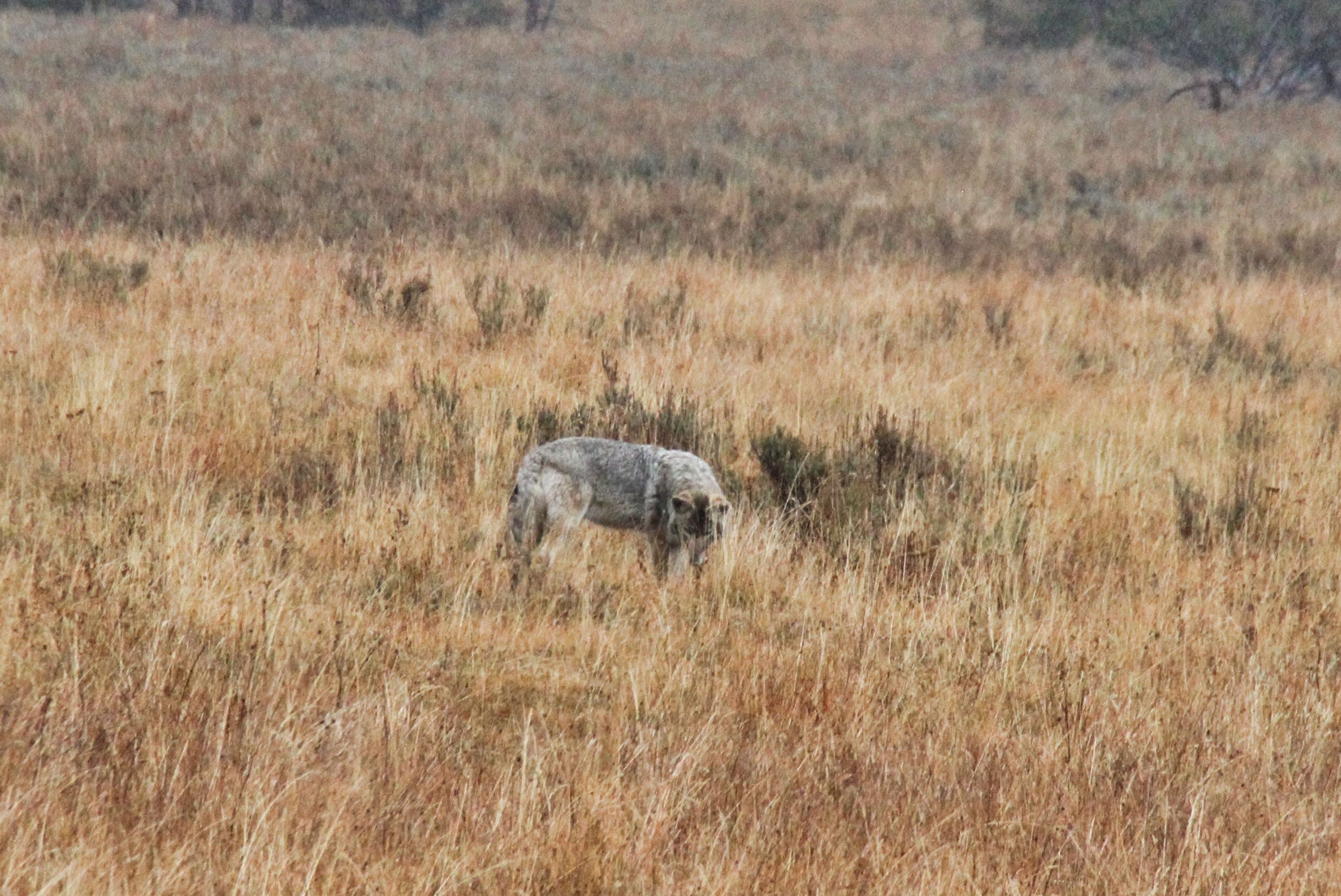
The first three photos were taken along the Wildlife Loop road in Custer State Park. 


Pronghorn Antelope

A herd of buffalo was crossing a creek from the far meadow to the near one.

After driving the Wildlife Loop, we followed the advice of the desk clerk at our motel and drove the scenic Iron Mountain Road. The scenery is a main attraction, of course; but the tunnels, through which Mount Rushmore is visible, are possibly the key feature of this drive.


We didn't go to the official viewing site of Mount Rushmore, but there were plenty of views as we drove back to and through Custer State Park.


The presidents whose likenesses have been carved into the side of the mountain at Mount Rushmore are George Washington, Thomas Jefferson, Theodore Roosevelt, and Abraham Lincoln, representing the birth, growth, development, and preservation  of the United States of America.

The profile of George Washington is visible from the Profile View turnout.

Sylvan Lake is another beautiful spot in Custer State Park.

Another very scenic part of Custer State Park is the Needles area. The rock formations there are something to see. The most popular feature of the the Needles is the Needles Eye Tunnel. Few can resist the challenge of driving a vehicle through the narrow opening. The following collage shows a vehicle going through to the other side, then the empty tunnel, then another vehicle entering the tunnel from the other side. Meanwhile, the small parking lots on each side are filled with people trying to get pictures.


Another scene along the Needles Highway

Now, a story about our very first visit to Custer State Park as a couple. I had been there many years before, traveling alone. I loved it and wanted to show it to Doug after we were married. So, on our first trip west in 1988, I planned a drive-through visit. I wasn't sure Doug would like it as much as I had, so I hadn't made any plans to stay overnight.

But Doug loved it, and we spent so much time taking in the sights that it was soon going on 9 PM. We hadn't had supper; we needed gasoline; and we didn't know where we'd find a place to stay that night.

The Blue Bell Lodge, located in Custer State Park, consisted of cabins, a restaurant, and a gas station. The gas station had just closed when we pulled up to the pumps, but someone was still inside. He came out and agreed to let us get some gas. We explained our situation and asked if he could recommend a place where we might stay for the night. 

He said that Blue Bell Lodge had just had a cancellation on one of their cabins, and he would let us have that for a very modest price. And he even had the kitchen make us up a couple of sandwiches.

The cabin was wonderful, a real treat for us. We had a delicious breakfast at the restaurant the next morning before resuming our westward journey.

In the intervening years, we've taken many vacations out west, and I've often inquired about lodging at the Blue Bell. But the rates were always way out of our comfort zone.

It was a gift from the Lord that we were blessed with gas, food, and lodging there that night in 1988.

Anyway, we still couldn't afford to stay at the Blue Bell on this Last Hurrah trip, but we did eat at the restaurant that night, after all our sightseeing.

Doug entering the Blue Bell Lodge Dining Room

Inside the Dining Room

Supper at the Blue Bell was a perfect way to wrap up a wonderful day of sightseeing. Wyoming was next on our agenda. More on that next time.


Related Posts Plugin for WordPress, Blogger...